Equipment installation
Overlimit Detection
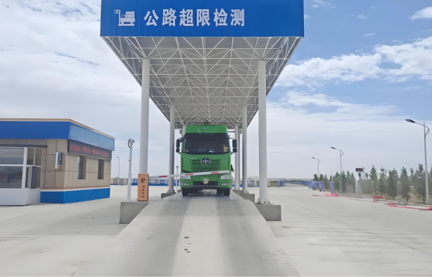
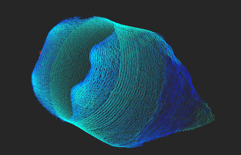
LIDAR (Light Detection and Ranging) is deployed at key locations in the road detection area, such as toll station entrances and overlimit detection stations. Its advanced scanning technology can accurately capture the three-dimensional contour information of passing vehicles. The system performs in-depth analysis on the scanned data to quickly and accurately calculate key parameters of the vehicles, such as actual dimensions, weight distribution, and cargo volume. Compared with traditional overlimit detection methods, this system provides more intuitive and precise detection results, offering solid data support for law enforcement decisions by traffic management departments.
Advantages of the Solution:
Precision Measurement: The system is equipped with high-precision LIDAR and advanced algorithms to accurately measure overlimit indicators of vehicles.
Easy Integration: It can be seamlessly integrated with existing traffic management, toll collection, and monitoring systems without the need for large-scale modifications, reducing deployment costs and implementation complexity.
Scalability: The system is highly flexible and can be customized with optional components and functional modules as needed.
Data Management: The system provides an intuitive interface for data viewing, facilitating analysis and decision-making.
Advantages of the Solution:
High Accuracy: The use of advanced point cloud processing algorithms and deep learning models provides reliable basic data for traffic law enforcement.
Fast Response: The system can complete data collection in an extremely short time as vehicles quickly pass through the detection area, reducing traffic congestion.
Easy Integration: It supports data interaction and linkage with other traffic management systems.
Flexible Expansion: Functions can be expanded according to actual needs.
LIDAR (Light Detection and Ranging) is deployed at key locations in the road detection area, such as toll station entrances and overlimit detection stations. Its advanced scanning technology can accurately capture the three-dimensional contour information of passing vehicles. The system performs in-depth analysis on the scanned data to quickly and accurately calculate key parameters of the vehicles, such as actual dimensions, weight distribution, and cargo volume. Compared with traditional overlimit detection methods, this system provides more intuitive and precise detection results, offering solid data support for law enforcement decisions by traffic management departments.
Advantages of the Solution:
Precision Measurement: The system is equipped with high-precision LIDAR and advanced algorithms to accurately measure overlimit indicators of vehicles.
Easy Integration: It can be seamlessly integrated with existing traffic management, toll collection, and monitoring systems without the need for large-scale modifications, reducing deployment costs and implementation complexity.
Scalability: The system is highly flexible and can be customized with optional components and functional modules as needed.
Data Management: The system provides an intuitive interface for data viewing, facilitating analysis and decision-making.
Vehicle Type Recognition
The system uses LIDAR deployed at key points on the road to collect point cloud data of passing vehicles in real-time and construct high-precision three-dimensional contour models. Based on deep learning algorithms, it intelligently analyzes the vehicle's exterior features, structural proportions, and component dimensions to quickly and accurately identify various types of vehicles. Whether it is common passenger cars, large buses, heavy trucks, or special-purpose engineering vehicles and special vehicles, the system can complete precise identification during the vehicle's travel and automatically match the vehicle type database to obtain the standard parameters of the corresponding vehicle type.Advantages of the Solution:
High Accuracy: The use of advanced point cloud processing algorithms and deep learning models provides reliable basic data for traffic law enforcement.
Fast Response: The system can complete data collection in an extremely short time as vehicles quickly pass through the detection area, reducing traffic congestion.
Easy Integration: It supports data interaction and linkage with other traffic management systems.
Flexible Expansion: Functions can be expanded according to actual needs.
Traffic Flow Detection
LIDAR is deployed at key road nodes and intersections. By analyzing the collected point cloud data in real-time, the system can accurately identify the number of vehicles in different lanes and precisely calculate traffic flow, providing reliable data support for traffic management.Show


 EWBSITE:www.njgzb.com
 CONTACT:Mr Wang
 MOBILE:15195977196
 E-MAIL:njgzbai@163.com
 ADDRESS:NO. 12 Jinlan Road Jiangning AREA NANJING CITY CHINA


